Walker's Map 
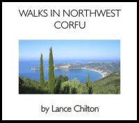
Twelve walks exploring the lush hills and beautiful green countryside around these beach resorts situated on the NW coast of Corfu, including routes around the villages of Afionas,
Agios Georgios North (Agios Georgios Pagon),
Agios Stefanos,
Arillas, Armenades, Kavadades, Krini, Lakones, Magoulades, Makrades, Pagi, Paleokastritsa, Prinylas and Vistonas, to the pretty bays at Porto Timoni and to the spectacular ruins of the Norman castle of Angelokastro. In spring, watch
fireflies dancing over the streams at night.
Large-scale sketch maps of the villages Afionas, Agios Stefanos, Arillas, Armenades, Kavadades, Krini, Makrades, Pagi, Prinilas, and Vistonas are included within the text.
Accompanied by an A2 colour walkers'
map of the Agios Stefanos-Arillas-Agios Georgios-Angelokastro area, at a scale of 6cm: 1km.